Cothelstone Hill, Quantock Hills, Somerset
Distance 2.5 miles
Start/finish Cothelstone Hill car park, Broomfield, Taunton
How to get there By car, 6 miles west of M5 junction 24
Standing on the summit of Cothelstone Hill on the southern edge of the Quantocks, the circle of beech trees known as the Seven Sisters is thought to mark the outline of a prehistoric platform cairn. Further fascinating remnants of the hill’s long history of human activity include bronze age barrows and the ruins of an early 20th-century tower. To reach the top, follow the obvious path straight up from the car park – on a clear day the views stretch to Wales. Descend the far side to return along the hill’s wooded southern flanks. Cothelstone is open access land, so exploring is encouraged. Fyne Court (National Trust, free entry, no booking required) with its wild, rambling grounds and cafe, is a mile away.
Swanbourne Lake, Arundel, West Sussex
Distance 3.1 miles
Start/finish Fitzalan Pool car park, Queen Street, Arundel (500 metres from Arundel railway station)
How to get there By car, from the A27 follow signs for Arundel Castle. Regular trains to Arundel station
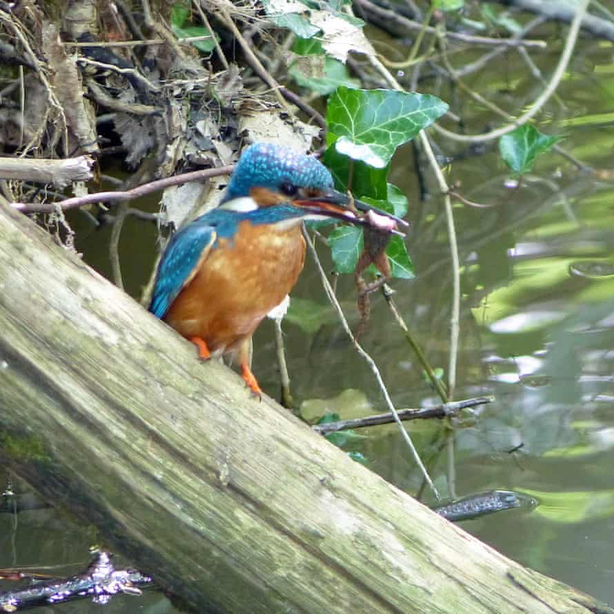
Start from the museum end of the car park, picking up the riverside trail and following a wide loop of the River Arun to reach the wetland centre (paid entry), home to glow worms, bee orchids, bats, warblers and rare blue ducks. Bear left, away from the river, tracing the edge of the wetlands and crossing the road to reach Swanbourne Lake. Follow the footpath around the lake, its clear chalk-bed water offering a window into the world below. Return alongside the road below the towers and turrets of Arundel Castle, the oldest part of which – the motte, a grassy artificial mound – dates to 1068. Tarrant Street Espresso, a few minutes’ walk from the start, serves a restorative flat white and brownies.
Uffington White Horse, south Oxfordshire
Distance 2.2 miles
Start/finish White Horse Hill National Trust car park
How to get there By car, signed off the B4507 west of Swindon
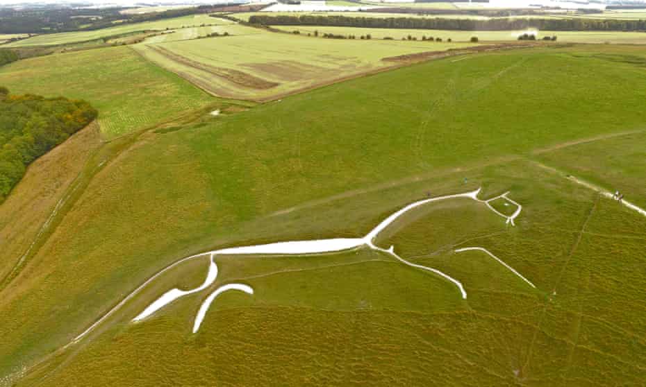
Formed from 80 million-year-old chalk, White Horse Hill is a natural playground dotted with ancient sites and steeped in mythology. In summer, its chalk grassland is alive with butterflies, bees and wildflowers. From the car park, walk diagonally uphill, crossing a road to reach the iron age hill fort at Uffington Castle. Explore the castle then continue through a gate on to the Ridgeway. Turn left then left again, descending steeply to the right of the white horse, first carved here in the bronze age. Below and left is Dragon Hill, the legendary site of St George’s battle. Follow paths down the dry valley of the Manger, turning left at the bottom and following the road back to the car park. Woodfired pizzas and views of the horse await at the Fox & Hounds in Uffington.
Wicken Fen national nature reserve, Cambridgeshire
Distance 2.8 miles
Start/finish Wicken Fen National Trust car park
How to get there By car, 17 miles north-east of Cambridge, off A1123. By bike on NCN route 11
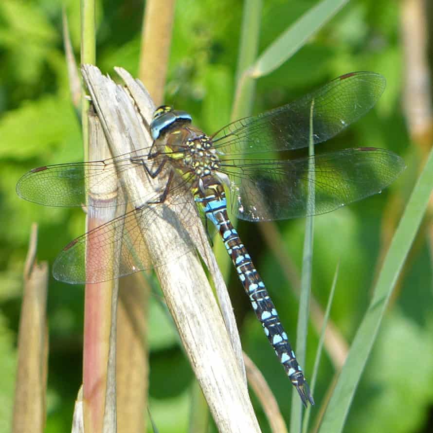
This walk follows the waymarked Adventurers’ Trail at Wicken Fen, the National Trust’s oldest nature reserve. Covering 809 hectares (2,000 acres) of grass and wetland, the reserve is home to more than 9,000 species. Herds of Konik ponies and hairy Highland cattle graze on the rough scrub, while keen-eyed wildlife watchers might even spot the more elusive muntjac deer, hares, water voles and lizards. On warm days the air fills with the buzz of insects, the rattle of dragonflies and the calls of waterbirds. No booking required for this walk. The cafe at the start/finish is open daily.
Caer Caradoc Hill, Shropshire
Distance 4.5 miles
Start/finish Church Stretton train station
How to get there: Trains to Church Stretton. By car, off A49 south of Shrewsbury
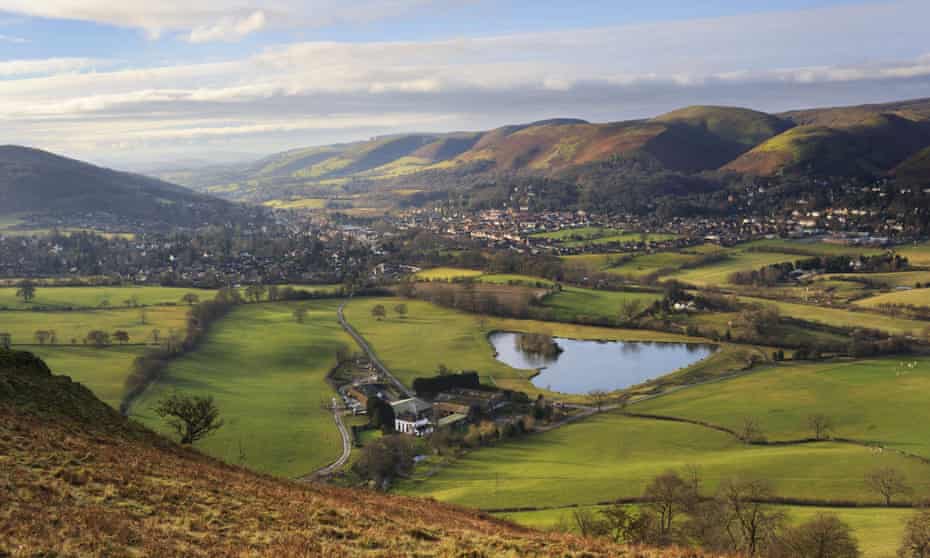
Amid the Shropshire Hills, Church Stretton is a great base for walking. To the west is popular Carding Mill valley with the Long Mynd beyond, while to the east lies an area of smaller, steep-sided hills, backed by the limestone escarpment of Wenlock Edge. Caer Caradoc – Welsh for Caradog’s fort – rises from the narrow valley of Stretton Gap, the hill fort at its summit dating to the iron or late bronze age. Leaving town along Watling Street North, this walk climbs steadily, following footpaths to reach Three Fingers Rock at the top. Continue along the ridgeline north-east to reach the fort, staying on the main path to reach a gravel track and turning right to return to the start.
Bakewell and the Monsal Trail, Derbyshire

Distance 3.3 miles
Start/finish Bakewell Station (Monsal Trail) car park
How to get there By car, off the A6 Matlock to Buxton
A family-friendly cafe at the halfway point and the option of a buggy-friendly out-and-back make this walk ideal for those with younger children. A former railway, the Monsal Trail is a nine-mile walking and cycling trail linking Bakewell with the outskirts of Buxton. Winding through limestone cuttings, echoing tunnels and over the viaduct at Monsal Head, it’s also an atmospheric cycle ride. This walk tackles a short stretch of the trail between the former stations of Bakewell and Hassop. From Hassop station, where there’s a cafe, play area and bike hire, either return the same way or, for the more rugged alternative, continue on the Monsal Trail, taking the next left on to a rough bridleway over open hillside and back into Bakewell.
Hardcastle Crags, West Yorkshire
Distance 4 miles
Start/finish Midgehole car park, Hebden Bridge
How to get there By car, 1.5 miles north-west of Hebden Bridge. Hebden Bridge railway station is 2 miles away. By bike via NCN route 68
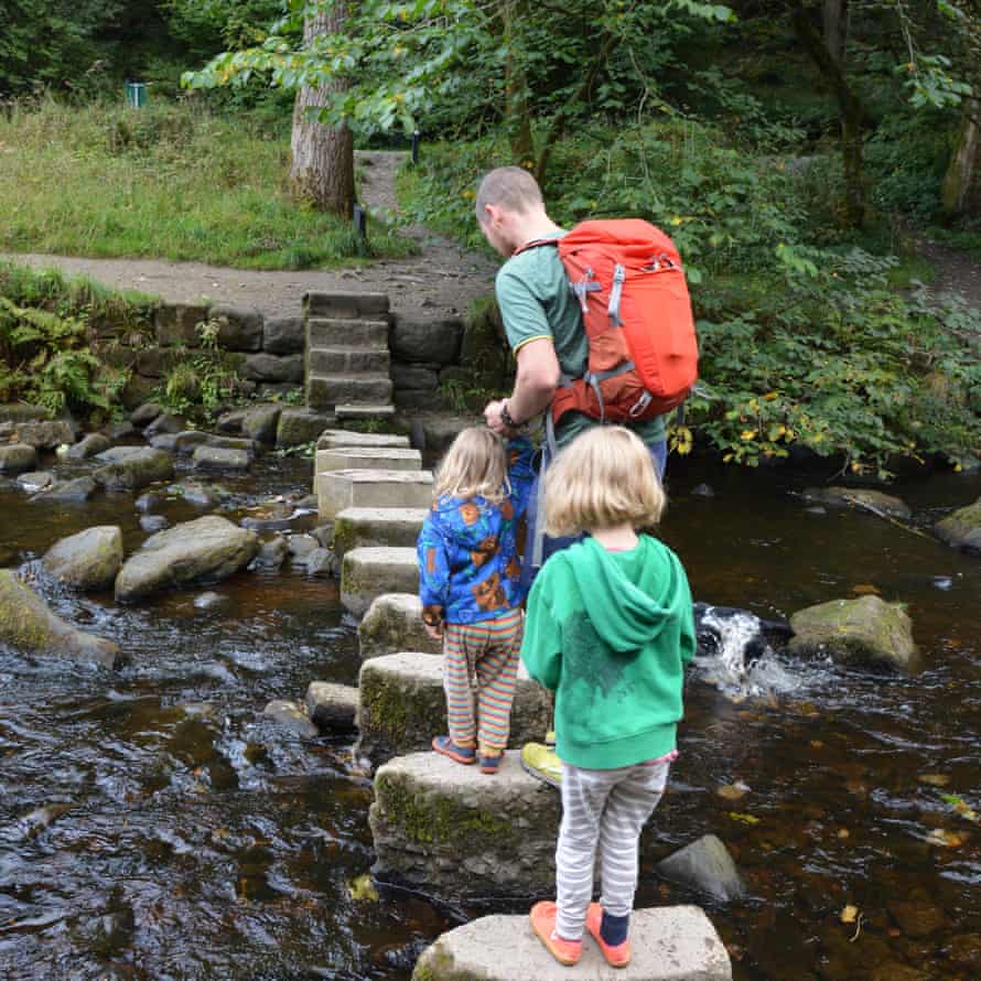
Within a wooded valley, dotted with rocky outcrops and cut through by the fast-flowing Hebden Water, Hardcastle Crags feels like a place from another time. The waymarked Mill Walk follows the riverside path upstream, passing a series of weirs and millponds, echoes of the area’s industrial past, eventually reaching a stepping-stone crossing. A little further on is the turnaround point, the 19th-century Gibson Mill, a former cotton mill and now a cafe – off-grid and self-sufficient in energy, water and waste treatment. The walk back explores dense woodland, covered in mosses and ferns – the trail is rocky and uneven in places, so less confident walkers may wish to return via the outward path. Look and listen out for woodland birds such as dippers, woodpeckers and nuthatches as you go.
Souter Lighthouse, South Shields
Distance 1.6 miles
Start/finish Souter Lighthouse, Coast Road, Whitburn
How to get there Just off the A183 between Whitburn and South Shields
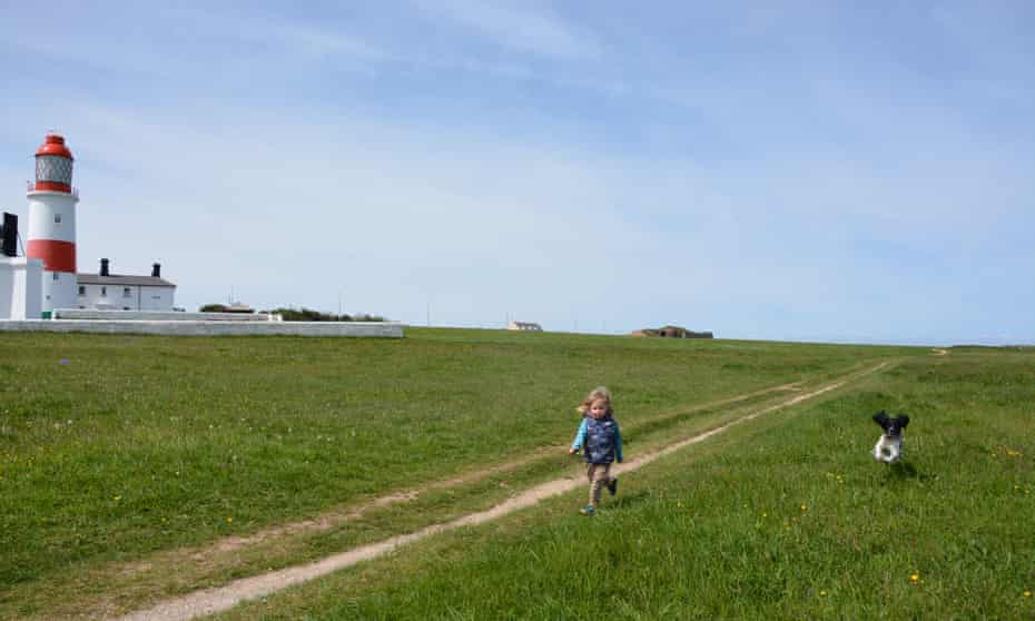
Walking the grassy trails around Whitburn coastal park, it’s hard to imagine that a bustling village, housing miners from nearby Whitburn Colliery and their families, stood on this site less than 70 years ago. Today, this is a place of grass and sky and sea, set against the red-and-white stripes of Souter Lighthouse, the first in the world to be powered by electricity. Fulmars, cormorants, guillemots and many other seabirds drift above the waves, while 5,000 pairs of kittiwakes nest at Marsden Bay to the north. A simple, circular walk looping the coastal park offers views of the cliffs and sea stacks, starting and finishing at the lighthouse. The cafe is currently takeaway only.
Castell Dinas Brân, Llangollen, Denbighshire
Distance 3.7 miles
Start/finish Llangollen Bridge
How to get there By car, A5 south-west of Wrexham. Parking at Market Street
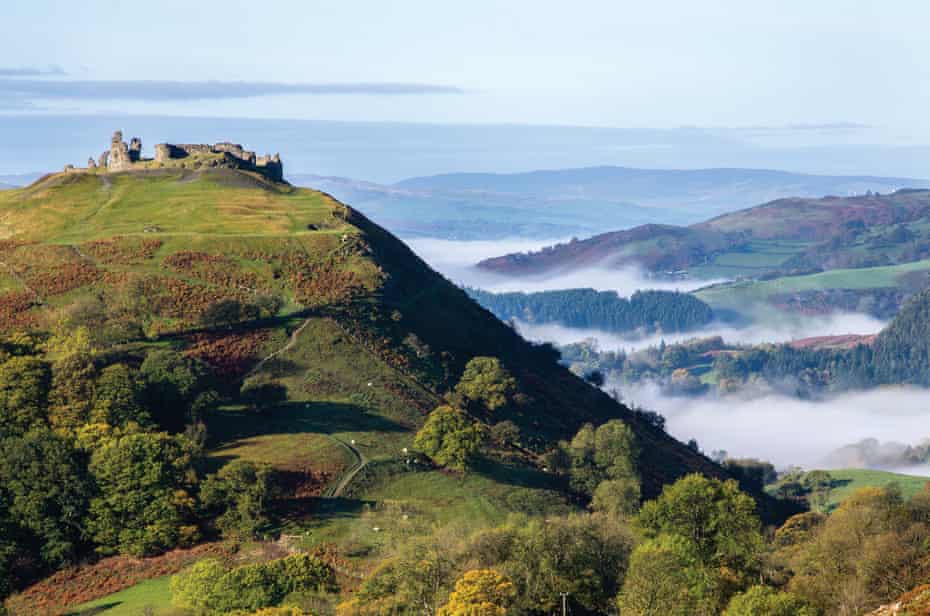
Climbing the steep hillside to reach the ruined 13th-century fortress of Castell Dinas Brân, it’s easy to imagine just a little of what its attackers over the centuries – from iron-age tribes to the medieval English – must have felt. Unlike in days long past, however, the castle is yours to explore when you get there. Start out heading east along the Llangollen canal, turning left at the first bridge and crossing fields to reach the castle. Descend the zigzag path down the western slope and continue downhill all the way back to Llangollen. Afterwards, watch daredevil kayakers from the deck at the family-friendly Corn Mill pub. The much-photographed Pontcysyllte aqueduct and Horseshoe Falls are a couple of miles further along the canal.
East Lomond, Fife
Distance 1.6 miles
Start/finish East Lomond car park, near Falkland, OS grid reference NO252058
How to get there From Falkland, head south-east on the A912 for 1 mile, turn right to reach car park
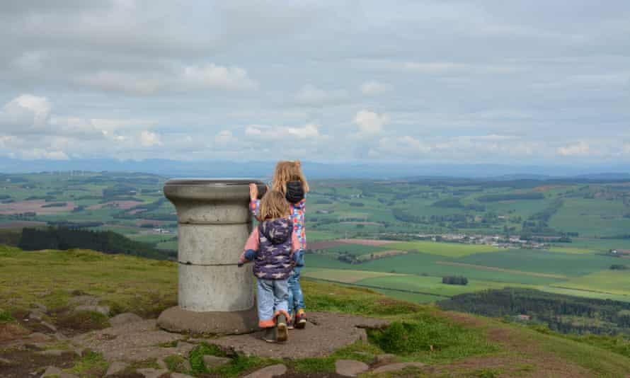
Also known as Falkland Hill, East Lomond overlooks the pretty town of Falkland, with its Renaissance palace, inspired by the chateaux of France and once a haunt of Mary, Queen of Scots. From the high-level car park it’s a straightforward walk to the summit, with its large stone topograph and views across the Fife countryside to neighbouring West Lomond and the Forth estuary. For a longer walk, start from the centre of Falkland, finishing through the fascinating features of the Maspie Den, with its waterfall and network of paths, laid out in the 19th century to showcase the Falkland Estate. A short detour takes you to the Pillars of Hercules organic farm shop and cafe, a mile west of Falkland.
Jen and Sim Benson are the authors of 100 Great Walks with Kids (Bloomsbury, £16.99), which is available at The Guardian Bookshop


