Times include swimming and a picnic. Only experienced swimmers should take on the swims referred to here.
Poltesco and Cadgwith, the Lizard peninsula, south Cornwall
Start/finish Ruan Minor
Distance 3 miles, allow 3 hours
This walk incorporates some beguiling aspects of Cornwall’s history, from a historic serpentine quarry to a working fishing village, along with an unusual swim into a collapsed cave known as the Devil’s Frying Pan.
Start from Ruan Minor, a village just inland, and descend to the coast, crossing the bubbling Poltesco stream on the way. At Poltesco Barn, stop and look at a small exhibition about the serpentine mining that used to take place at the beach nearby. It is then a very short distance to said beach, little-known Carleon Cove, where you can see the stone ruins of the serpentine quarry that did big business here in the 19th century. Serpentine is a red and green stone found locally, which was fashioned into ornamental pieces including fireplaces, vases and gravestones.
There is also a substantial round building on the beach, the old Capstan House, which contained a winch for hauling pilchard boats. The sea is beautifully clear in this rocky cove and it’s perfect for swimming. There’s also a pond if you fancy a freshwater dip.
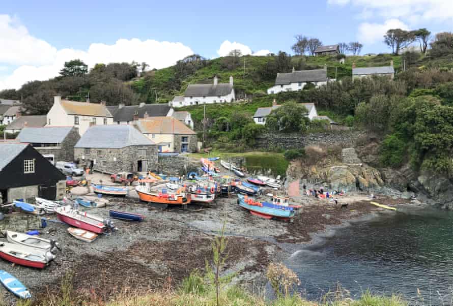
From the beach, rejoin the coast path and follow it south – there are spectacular views – to the working fishing village of Cadgwith. It has two beaches, one of which is packed with colourful fishing boats; the other, Little Cove, is better for swimming.
There are various places to stop for refreshment, including the Cadgwith Cove Inn and the Old Cellars. If the sea is flat, and there is no wind, you can swim around to a collapsed sea cave called the Devil’s Frying Pan, which is a great adventure, involving swimming under a rock arch into a huge, circular inland pool, surrounded by cliffs (best at high tide). To find it, swim along the right-hand side of the cove and then turn right, following the coast south until you see the “bridge” which leads into the lagoon.
From Cadgwith the path leads past pretty cottages and heads back inland to Ruan Minor.
Carn Marth quarries circular, near Redruth, mid-Cornwall
Start/finish Gwennap Pit, where there is space for four cars
Distance 3.5 miles, allow 4 hours
A fascinating walk back through time, around a series of curiosities all related to the area’s rich mining history. These include an open-air church, an amphitheatre and two refreshing quarry pools.
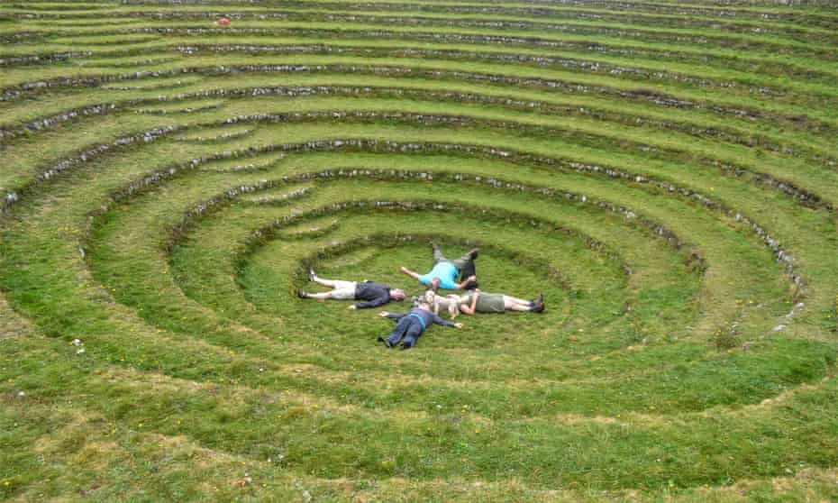
The starting point for this walk is a truly remarkable feature called Gwennap Pit, a conical amphitheatre created when the surface of an old copper mine collapsed hundreds of years ago. John Wesley, the father of Methodism, took advantage of the natural acoustics and used the pit to preach to his thousands of followers. The site was also popular with the Cornish rave scene in the 1980s, with local resident Richard David James, AKA Aphex Twin, holding legendary parties here.
Just past the pit, bridleways and paths will lead you up on to Carn Marth, an ancient hilltop blanketed in gorse, bracken, heath and wildflowers. Carn Marth Pool (or the Cornish Granite and Freestone quarry) once provided granite for a number of prominent buildings around nearby Redruth. It’s a lovely swim spot, with banks dropping down to its revitalising waters, where islands are waiting to be conquered. You’ll also spot fishers trying to catch carp that were released in the waters some years back, including an elusive 30-pounder.
The walk continues to another intriguing quarry, housing an open-air theatre where the likes of Kneehigh and Miracle Theatre perform. Very close to the entrance of the quarry you might be able to find some steps leading down to an old well, known as Figgy Dowdy’s Well, where young girls would once bring their dolls to be baptised every Good Friday.
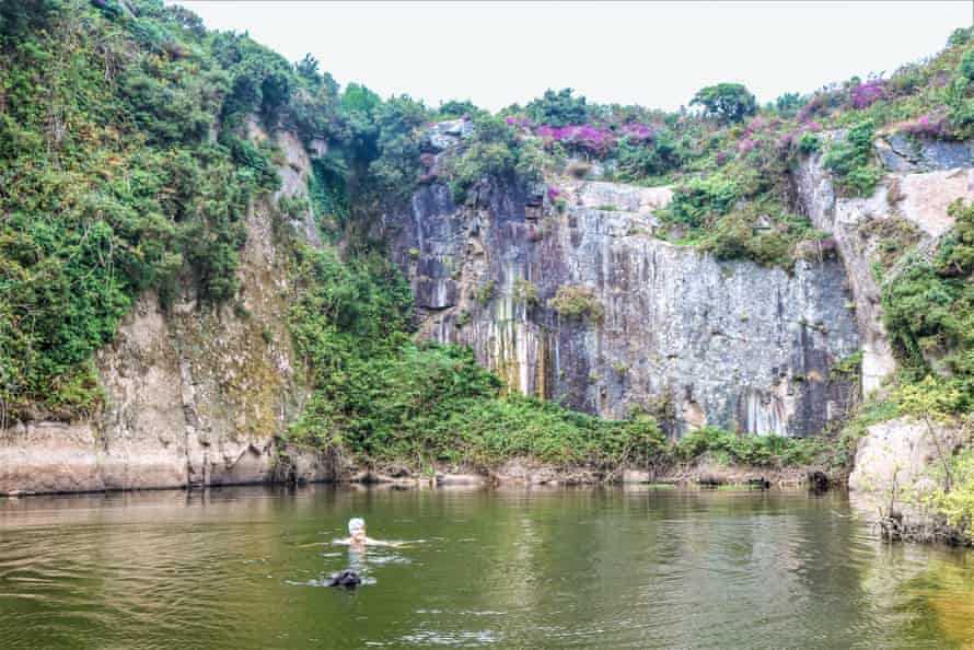
As you leave the quarry, you can see the chimney and ruins of Baronet’s Engine House, which once powered the mine’s pumping engine. Turn left to walk away from the mine ruins and it’s a 10-minute stroll to the next pool. It’s easy to miss, so look out for a small track off to the left. Known as Cathedral Quarry due to its high, sheer walls, it’s a magical spot. Swim from the natural granite steps and platforms into the refreshing waters. The walk then returns back down to the village through more pleasant lanes and bridleways. Near the end, stop in the quiet little village of Lanner, where there are a couple of pubs and a bakery selling excellent Cornish pasties.
St Nectan’s Glen and Bossiney Haven circular, near Tintagel, north Cornwall
Start/finish Parking area in Bossiney village
Distance 3.5 miles, allow 6.5 hours
This walk takes in an ancient place of pilgrimage, a dramatic rocky gorge and a beach with a natural arch. There are fresh and saltwater swims. For calm sea conditions, the walk is best done when the winds are easterly or south-easterly. Although the walk is relatively short, allow plenty of time as there is lots to see.
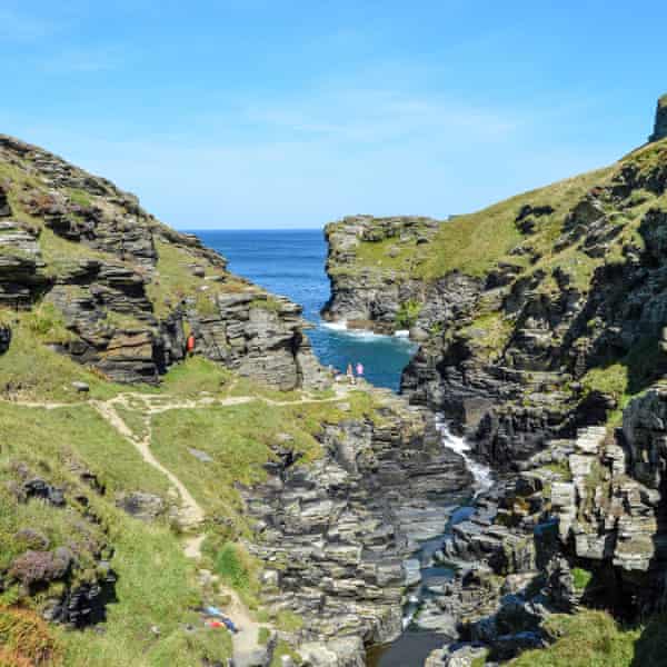
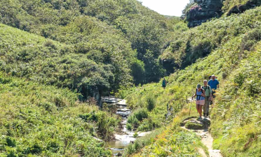
From the coastal village of Bossiney, the walk heads inland across fields, from where the route leads down into the enchanting woods of St Nectan’s Glen. The River Trevillet gurgles along at the bottom of the valley, leading to a vast waterfall. The Glen has been a place of mystery for centuries, with tales of fairies, piskies and spirits. Both Christians and Pagans see it as a sacred site. You have to pay a small fee to go down to see the waterfall. A column of water gushes from on high, thundering through two round holes into the shallow plunge pool below. You can stand under the water for an invigorating back massage.
From the waterfall, the walk goes past an old mine where there are two labyrinth carvings – like round mazes. There is a plaque from the 1950s which says they date from the bronze age, but more recent opinion is that they are no more than a few hundred years old. Shortly after, the walk enters Rocky valley, which is like a miniature slate version of the Grand Canyon. The River Trevillet flows through it, with a beautiful sequence of waterfalls, cauldrons and pools, before emptying into the sea.
From Rocky valley, it’s a steep walk to the top of the cliffs and the views along the coast are breathtaking. It’s a short distance down to Bossiney Haven, where there is an unusual rock arch called Elephant Rock. At high tide you can swim underneath the arch and around to a cave on the other side. A great little adventure to round off the walk.
Charlestown circular, near St Austell, south Cornwall
Start/finish Charlestown car park
Distance 3 miles, allow 5 hours for 3 swims and exploring
This walk starts (and finishes) in the historic port of Charlestown, and takes in glorious countryside as well as three beaches. If you’re a confident swimmer, you can swim the final part of the walk, either carrying your stuff in a drybag-towfloat, or getting your friends to carry your things on shore.
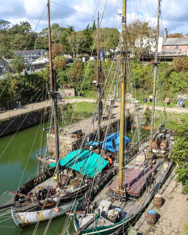
Charlestown is a charming place that’s part of the Cornwall and West Devon Mining Landscape, listed as a Unesco world heritage site. It was built between 1790 and 1810 as a port for the export of copper and china clay from the nearby mines. It is beautifully preserved, and its stone quays are home to several tall ships. Its picturesque appearance has given it a real lease of life in recent years, both for tourism and as a film and TV location, with appearances in Poldark and many other TV shows and films.
The walk heads out of the village and up along a bridleway that adjoins the golf club. It passes through a hamlet and a small church dedicated to St Levan, the Cornish patron saint of fishers. It then continues uphill into fields that overlook the sea.
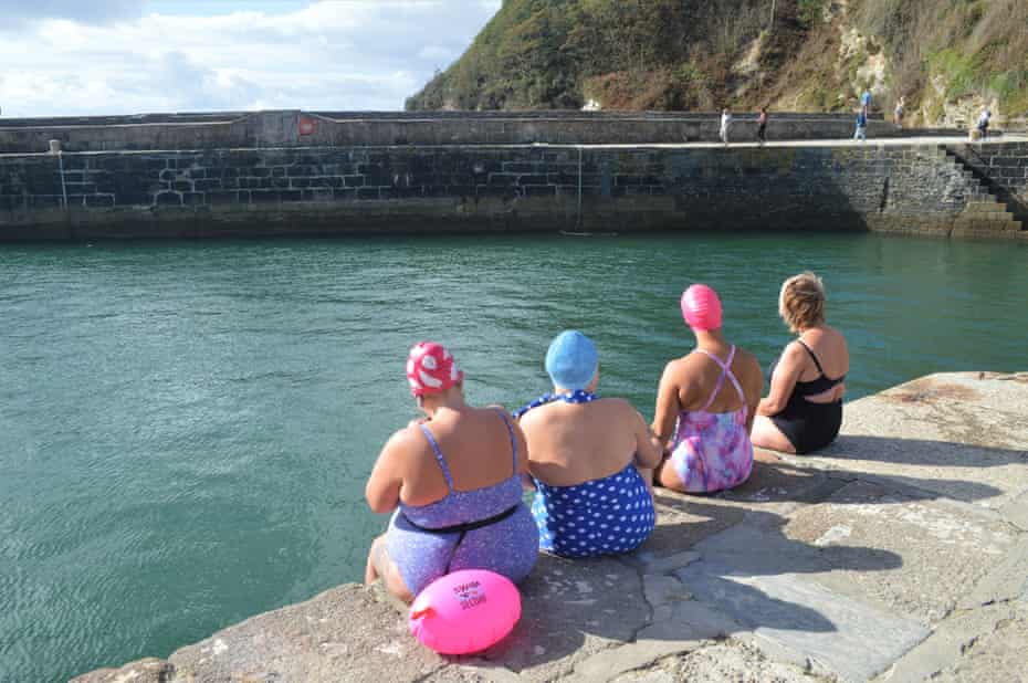
From here the route joins the coast path to the first swim spot at Porthpean. This is a lovely beach with beautifully clear water. If you want an aquatic adventure, set off from the left-hand side of the beach, where there are rocks and islets to explore. There is an unusual manmade hole called the Coffin Cave on the left-hand side. You can swim around to Duporth beach and, if you’re confident enough, back to the start at Charlestown. Otherwise the route continues on shore, heading up steps at the end of the beach and past a lookout tower at Carrickowel Point which was used by RAF Coastal Command for practice bombing in the second world war.
After more great views, the path leads down to Duporth beach, another fantastic swim spot, which is usually quiet, as there is no parking. From here it’s a short walk along the coast path through an old cliff battery to Charlestown.
Trelissick figure of eight, near Falmouth
Distance 5 miles, a good 4–5 hours with swims
Start/finish National Trust car park at Trelissick
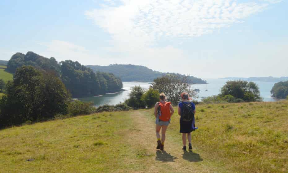
This is a proper swim safari, exploring the creeks of the River Fal and the wilds of the Trelissick estate with numerous swims on the way. It is best done around high tide.
Trelissick is a grand country house built in the 18th century in a commanding position overlooking the Carrick Roads – the name given to part of the River Fal which stretches out to be one of the largest natural harbours in the world. The walk heads south down the hill from the car park, arriving at a beautiful beach on Channals Creek, perfect for a swim. There are great views from the jade-coloured water, and directly opposite is Turnaware Point, which was one of the embarkation points for the D-day landings.
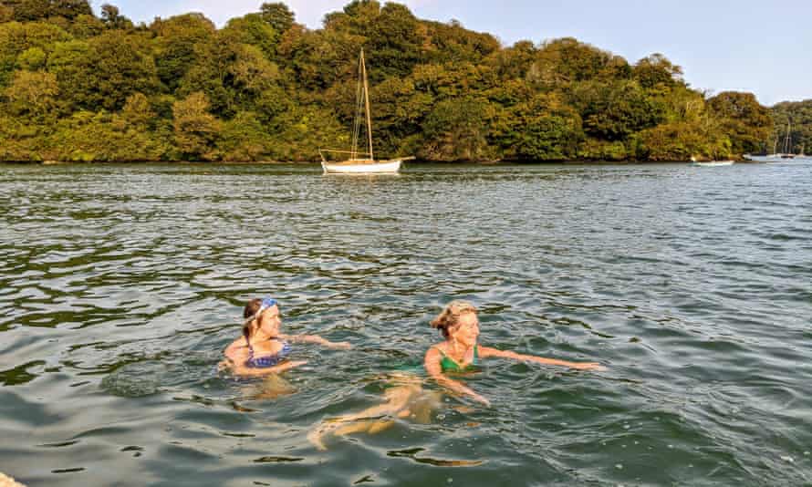
From here the route follows the shoreline north through the woods, which border the water, and passes the jetty for the King Harry Ferry, which carries both cars and foot passengers. It then passes along both sides of Lamouth Creek, another great swim spot at high tide, and where you can often see egrets, shelduck and kingfishers.
At the mouth of the creek is Roundwood Fort, an impressive promontory fort dating back to the iron age. Next to it is another great spot for swimming, Roundwood Quay, a handsome stone jetty which dates back to the 18th century, when there was a limehouse, a malthouse, a sawpit for shipbuilding and a coal yard here. With several slipways and sets of steps, it is a playful and picturesque spot to swim from.
From here, the walk heads back inland and completes the figure of eight back to the car park. If you have time, it is worth taking a look around the house and gardens.
Looe estuary adventure, east Cornwall
Start/finish Millpool West Looe car park
Distance 2.2 miles, allow 3 hours
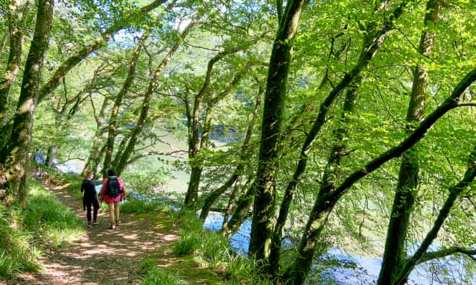
This is a glorious adventure, walking alongside a wooded estuary and swimming back down the smooth green river with the outgoing tide. Time the walk with high water and bribe a friend to carry your stuff back, or carry a drybag-towfloat behind you as you swim.
Looe is a delightful little town, nestling on the banks of the river that bears its name. There are two branches, the West Looe and the East Looe rivers, which form a confluence in the town and flow out to sea past all manner of quays, jetties and slipways. The walk starts at the bottom of the West Looe River, just before the confluence. The route heads through Kilminorth Wood, known locally as the “lungs of Looe”. The path stays close to the water most of the time, giving enticing glimpses of the beautiful estuary.
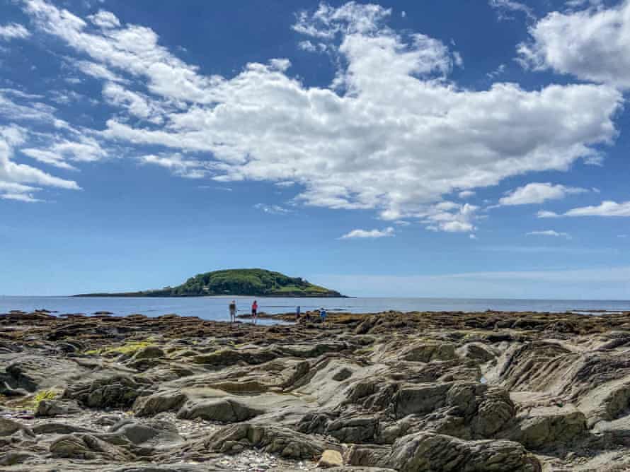
The walk emerges at the pretty hamlet of Watergate, where there is an idyllic campsite. At this point you can get in the river and swim back. The swim is best done at high water on a spring tide, when there will be maximum water in the river; start swimming about an hour after high water to get the best push.
On a neap tide you may have to wade from time to time, but this is all part of the fun. This is a great river for an adventure swim, because it is very safe and there are lots of get-out points. It truly is a magical experience. There is no evidence of human presence; the trees spread up the banks on either side and it feels timeless. There is a good chance of seeing birds, including kingfishers, herons, egrets and curlews.
The adventure finishes back at the start, where there is a slipway to get out, so enjoy the satisfaction of swimming back to where you began.
Wild Swimming Walks Cornwall: 28 coast, lake and river days out, by Matt Newbury and Sophie Pierce (Wild Things Publishing, £14.99)


