Buckskin Gulch is a gnarly rip in the desert that cuts a ragged path along the Utah-Arizona border.
At about 14 miles, it is the longest, deepest slot canyon in the U.S., maybe the world. The narrow labyrinth is strewn with obstacles — flooded passageways, quicksand, titanic boulders and rattlesnakes. It’s been called one of the best hikes in America.
As a slot canyon aficionado, I had to see for myself.
Slot canyons, formed by millions of years of water rushing over rock, are addictive. They draw you in, squeeze you between walls often just inches apart, then throw problems at you — water, mud, debris and the nagging threat of flash floods. Southern Utah has more than a thousand slots, the most anywhere. Some are easy, some are hard. Most are too short. Not Buckskin.
I set out in late October when water levels in Buckskin were low and the forecast showed zero chance of rain. Even a quarter-inch can trigger a deadly flash flood that can blast you down the canyon.
Wire Pass leads a solo hiker to the entrance of Buckskin Gulch.
(Brian van der Brug/Los Angeles Times)
The sky was deep blue, the temperature a gorgeous 65 degrees.
I met up with my friend and his wife in Page, Ariz., about 30 miles southeast of Buckskin, which lies within the Paria Canyon-Vermilion Cliffs Wilderness Area, straddling Utah and Northern Arizona.We parked my car at the White House campground, and their car 15 miles away at Wire Pass, where we started the hike at 8 a.m.
You can also begin at the Buckskin Gulch trailhead, but that entails several miles of underwhelming hiking before reaching the more spectacular, narrow parts of the canyon. The more popular Wire Pass, a short slot canyon, drops you into Buckskin after just 1.7 miles.
Our hike would total about 21 miles — 14 through Buckskin Gulch and seven more up the Paria River to the White House campground where I parked. A long day.
We quickly reached Wire Pass and descended its slender confines, emerging into a broad, sunny grotto of sand and cottonwoods. Ancient petroglyphs of bighorn sheep, snakes and mysterious human-like forms adorned the black walls.
We hiked over the soft sand until we reached massive sandstone blocks guarding the dark passage into Buckskin. The walls rose 200 feet around us. Shadows lengthened. Thin shafts of sunlight cast an orange glow on the canyon floor.
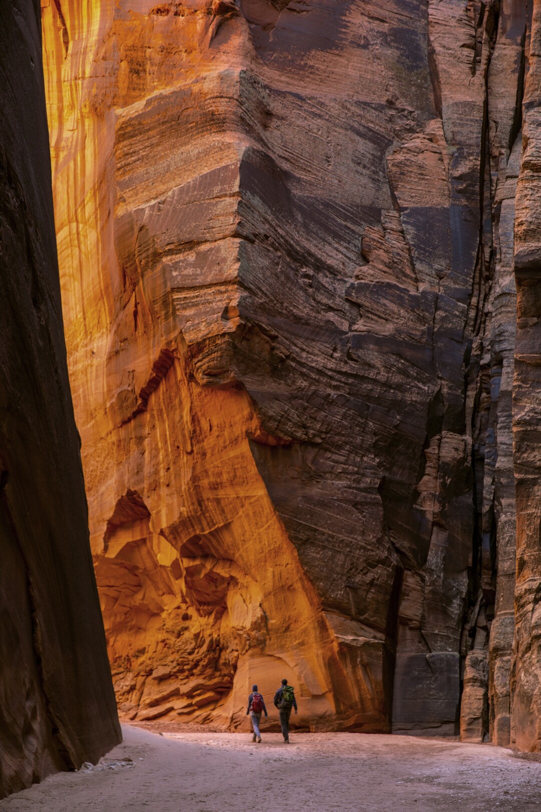
Hikers walk along a sandy trail flanked by the massive sandstone walls of Buckskin Gulch.
(Brian van der Brug/Los Angeles Times)
Ahead were Rodney and Stacey Shaw of Austin, Texas, gaping at the forbidding stone ramparts before them.
“We plan to drive to the Grand Canyon later today so we can’t stay too long,” said Rodney, a Pentecostal pastor.
We ran into them a mile later. “I thought you were leaving,” I said.
“Every time we try to go, this place just sucks you in deeper,” he replied.
I embraced that suck and pushed on. The scale was epic. We were ants in a brooding geological Oz. The serpentine walls narrowed to four feet across. The sunlight dimmed. Inky black alcoves appeared to the left and right.
My mind conjured images from “`Lord of the Rings.” The gloomy mines of Moria, the tunnel of Shelob, the giant spider that skewered Frodo Baggins before neatly wrapping him in silk.
Logs were suspended between the walls high above us, testimony to the power of flash floods.
There were voices ahead. A man in the shadows hurled rocks into a trough of watery muck, each landing with a hollow `plop.
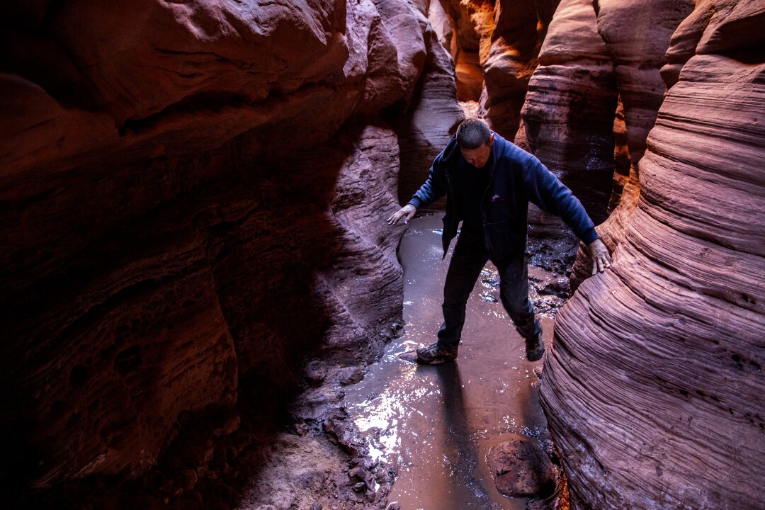
A hiker navigates the “cesspool” filled with putrid water inside Buckskin Gulch.
(Brian van der Brug/Los Angeles Times)
Nathan Peters, a carpenter and helicopter pilot from Athens, Ga., was trying to bridge the “cesspool,” an obstacle known for its standing, putrid water.
He and his 18-year-old daughter Shay were exploring the Southwest in their customized van.
“Fortunately, I like to play in the mud,” he said.
The water levels were low that day; sometimes they’re waist- or neck-high.
While her dad labored on his bridge, Shay climbed the canyon wall, found a narrow ledge and inched her way over the trench below. She dropped down on the other side. Problem solved.
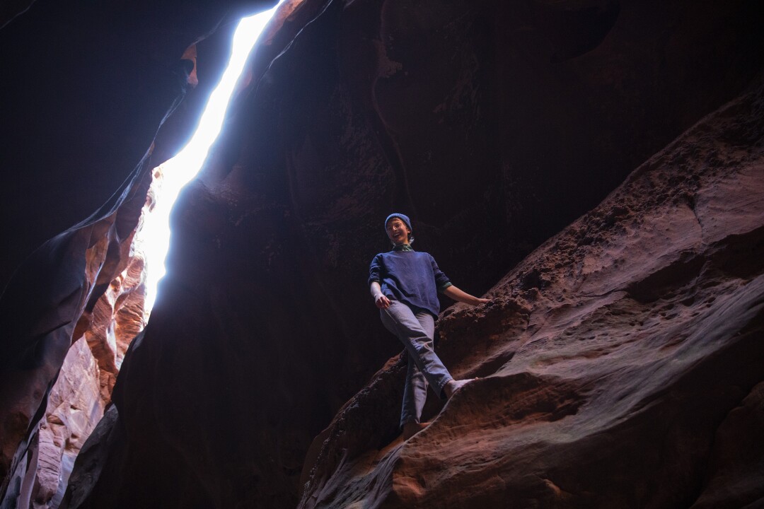
A hiker pauses on a canyon wall inside Buckskin Gulch where she climbed to avoid a pool of putrid water.
(Brian van der Brug/Los Angeles Times)
We middle-agers weren’t so nimble. I stepped on a rock. Then another. The third gave way and I sunk knee-deep into the syrupy muck. Both shoes nearly came off as I climbed out. My friends met the same fate.
We moved on, leaving Peters to finish his rock bridge. We eventually reached a low spot in the canyon called the Middle Route, where you can scramble 100 feet up and out in case of a flood — assuming you’re close to this spot when it hits.
An hour or so later we faced the infamous “boulder jam,” a collection of massive rocks that seemed to block the way forward. We peered down a chute into an opening called the “Rabbit Hole.” Luckily, it was clear of debris. If it’s clogged you can climb down a set of “stairs” cut into the rock. A rope is sometimes in place to help you. The rope was there, but I brought my own just in case.
We slid our packs through the hole, then eased down the 10-foot-chute using another fixed rope to control our descent. We ducked out and were in the clear.
Now the canyon sunk even deeper.
We rounded corner after dark corner, like trespassers creeping through the dank keep of some medieval fortress. Orange and black walls more than 400 feet high hemmed us in. Each had a pattern. Wavy black rock polished smooth by water. Undulating shark fins. Zebra stripes. Higher up, indentations and outcrops resembling human faces stared down at us.
The stunning views just kept coming, yet I felt a creeping sense of claustrophobia. When would this canyon open up? Was that the wind or the roar of floodwaters? Could I scale this wall if I had to? What just darted past?
Then Buckskin slowly widened. A dead raven lay at my feet. A bad omen? A live robin flitted by. A good omen? A ribbon of water flowed toward us. We were nearing the confluence of Buckskin Gulch and the Paria River, a silty, greenish tributary of the Colorado. The sun appeared. I felt a surge of happiness as we emerged from the darkness.
A camping area lay ahead. We turned left and headed upriver through Paria Canyon.
It was almost 5:30 p.m. I had hoped to finish before nightfall so we wouldn’t have to look for the trail exit in the dark. But I figured we could cover the last seven miles in a few hours. I didn’t realize we’d be walking mostly in the Paria, not along its banks.
We crisscrossed the shallow river repeatedly, trying not to slip or get mired in the mud.
I started counting river crossings — 19, 45, 75.
It was dark now. We used flashlights and headlamps to guide us. The water was cold. Before leaving home, I had taken a photo of a YouTube video showing two rock formations near the exit for White House campground. I scanned the canyon walls for silhouettes of the rocks. Nothing.
As a full moon and stars filled the sky, we were three little lights bobbing back and forth across a burbling desert river seeking the refuge of a battered Prius.
Had we passed the exit? I climbed a hill for a better look. A red flash appeared. Brake lights! Highway 89 was up ahead.
We moved up a sandy bank and spotted a tent, then my car. It was 9 p.m. We had hiked 21 miles and crossed the Paria River 123 times. We were tired, wet, filthy and exhilarated.
So is this one of the best hikes in America? Absolutely.
Buckskin began as a hike, became a slog and turned into an adventure. We spent the day creeping through a forbidding gash deep inside the Earth and the night struggling up a lonesome river in the middle of the desert.
Physically, I’ve been on tougher treks. Mentally nothing compares.
This one will stay with me for the rest of my life.
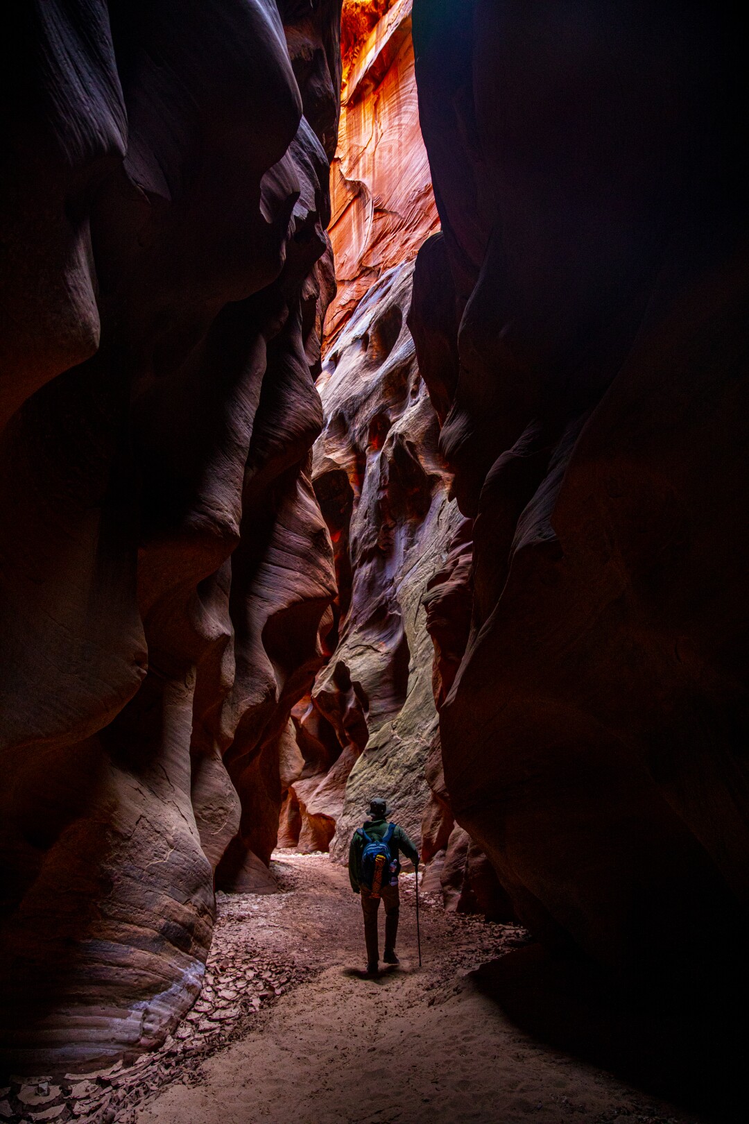
A lone hiker is flanked by the serpentine walls of Buckskin Gulch.
(Brian van der Brug/Los Angeles Times)
If you go
Buckskin Gulch lies about midway between Kanab, Utah, and Page, Ariz., in the Paria Canyon-Vermilion Cliffs Wilderness Area. The day-use fee is $6 per person for ages 12 and older and $6 per dog. There are self-pay stations at Wire Pass and White House trailheads.
To do this as a day hike you must be mentally and physically prepared for constantly changing conditions. Walking for miles through water, mud and muck in a chilly, dark canyon can be daunting.
When to go: The best times are late fall and spring when there’s little chance of rain. But prepare for knee-, waist- and even neck-deep water at certain times. It stinks and is often numbingly cold.
For conditions and more information, go to the BLM’s Kanab Visitor Center at blm.gov/visit/kanab-visitor-center.
Check the weather; Buckskin can become a death trap in a flash flood. Make sure there is no chance of rain anywhere in the region. Blue skies mean nothing; rain 50 miles away can trigger a flood.
Car shuttle: Leave one car at the White House campground just off Highway 89 about 30 miles west of Page. You will turn left where you see the Paria Contact Station, then left again down a two-mile gravel road most cars can handle.
Leave the second car at the Wire Pass trailhead. After leaving White House, go left onto Highway 89 for about 4.9 miles, then take a sharp left onto House Rock Valley Road for 8½ miles to the parking lot. This dirt road is passable in a standard vehicle if it hasn’t rained.
You will see a road leading to the Buckskin Gulch trailhead as you head to Wire Pass. If you start there, you will add about three miles of rather unscenic hiking to your trip. Most people prefer Wire Pass, a narrow slot canyon, because it drops you into Buckskin after about 1.7 miles.
There also are shuttle services in the surrounding areas that can provide transport between trailheads.
What to bring: Bring water especially when it’s hot. I brought three liters and drank only one. But it was October. I also brought a flashlight (critical); a phone charger (necessary for all the photos you’ll take); walking poles (used them to judge water depth until one snapped); and a 40-foot rope four the boulder jam in case one isn’t in place (didn’t need it). I wore long pants, sweatshirt, hat and sneakers with wool socks.
Spooky Gulch
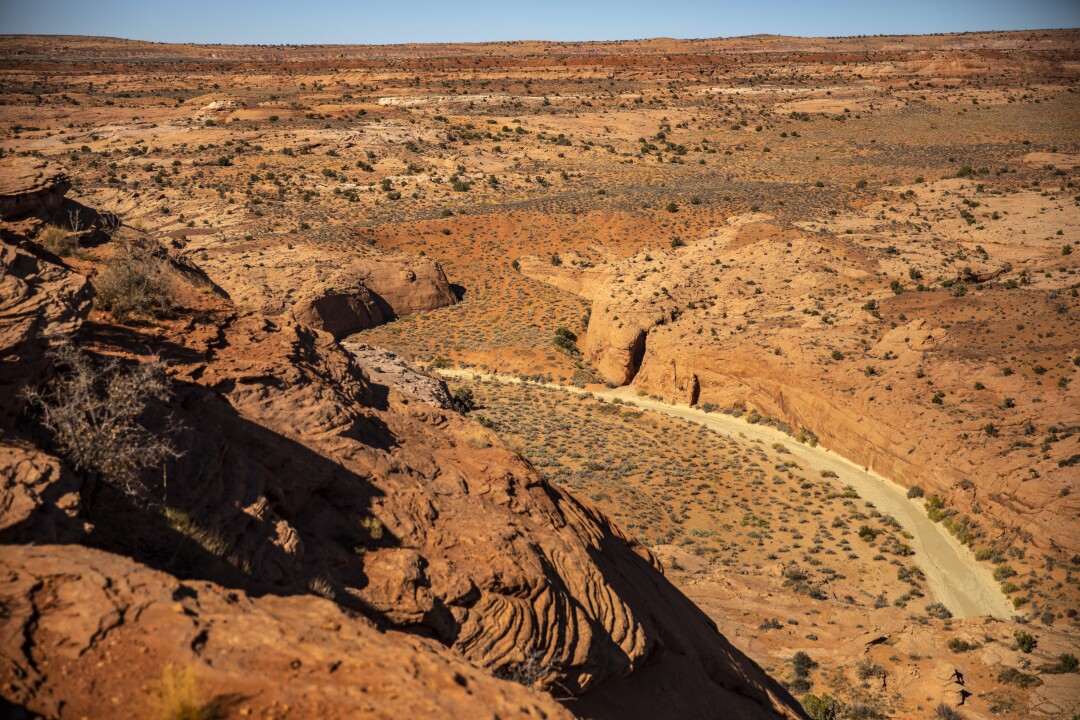
The view from a high ledge reveals the entrance to Peek-a-Boo and Spooky Gulch slot canyons .
(Brian van der Brug/Los Angeles Times)
ESCALANTE, Utah — A day after doing the 21-mile Buckskin Gulch hike, my friends and I headed north to exploreother slot canyons, shorter but with their own peculiar attractions.
Buckskin may be the longest, deepest slot canyon on Earth, but Peek-a-Boo and Spooky Gulch may be the skinniest, at only 8 to 10 inches across at points. Zebra Canyon, barely 300 feet long, is known for its stunning pink and white stripes.
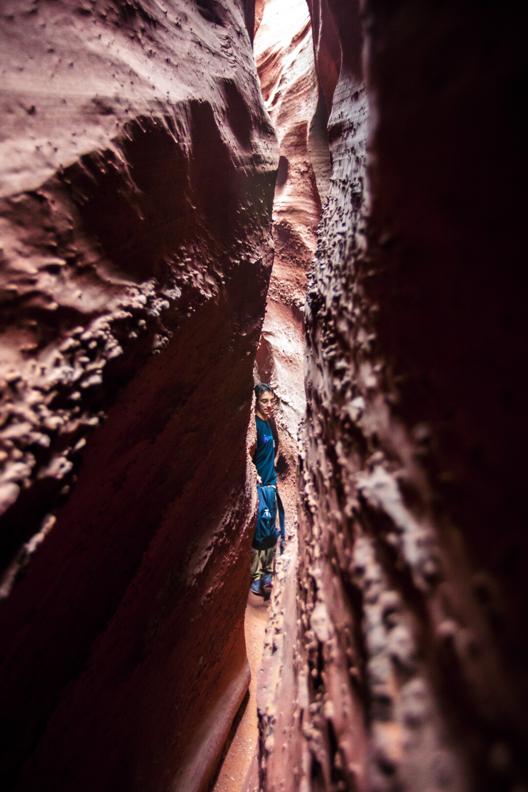
The narrow walls of Spooky Gulch close in to about 8 inches.
(Brian van der Brug/Los Angeles Times)
We traveled in separate cars, heading up Utah’s scenic Highway 12, passing stark red cliffs, crimson hoodoos and forests of twisted pinyon pines. Four hours later we reached the town of Escalante, where I stopped by the Escalante Interagency Visitor Center, run by the Bureau of Land Management, to inquire about conditions in the slots, which lay just outside the boundary of Grand Staircase-Escalante National Monument.
A ranger told me Spooky Gulch and Peek-a-Boo were clear. We had checked the weather forecast to make sure there was zero chance of rain to avoid possible flash floods.
We drove a few miles farther up Highway 12 and took a right onto Hole-in-the-Rock Road, a very bumpy washboard that nearly rattled my low-slung Prius into scrap. It took me an hour (about 26 miles) to reach the trailhead.
We walked along a high ledge overlooking a canyon where a small opening revealed the entrance to Peek-a-Boo slot. A returning hiker advised us to do Peek-a-Boo first, then follow the rock cairns to Spooky Gulch and loop back to the parking lot.
Most people hike in this direction to avoid encountering someone in a narrow canyon where passing is extremely difficult, often impossible. It’s easy to maintain your distance in a canyon as long as you’re not passing anyone, and there were few people around this day.
The only way into Peek-a-Boo from here was by climbing a sandstone wall about 20 feet high. We had already met a woman defeated by it.
“My legs are too short,” she said ruefully as she shuffled past.
We followed trail markers down the orange cliff sides to a muddy wash the color of minty green toothpaste. We missed the entrance, then backtracked to find it.
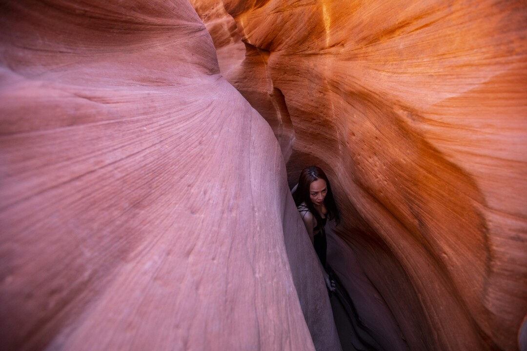
The peach-colored labyrinth of Peek-a-Boo Canyon is reached after scaling a 20-foot sandstone wall.
(Brian van der Brug/Los Angeles Times)
Karen Hoangand Fabian Gallee of Orange Country wandered up as we surveyed the wall before us. They were exploring Bryce Canyon and other Utah parks and wanted to experience a few slot canyons.
The wall was steep, but not as daunting up close as it was from afar. We found a few footholds that helped us get up and into the canyon entrance.
The peach-colored walls immediately closed in. A few feet at first, then down to 12 inches or so. The sense of compression was intense. We wandered through the stone labyrinth for 25 minutes before emerging into the open desert.
We followed rock cairns for a half-mile south to Spooky Gulch, where we were stopped by a roughly 10-foot drop just inside the canyon. We used a rope, already in place, to lower ourselves deeper into the slot.
“I didn’t expect to be doing this today,” Hoang said, dangling above the canyon floor.
The wavy walls, studded with orange sediment, swiftly closed to about 8 inches across. We moved sideways and continued downward. I regretted my decision to bring the backpack I now held over my head.
I stifled feelings of claustrophobia as I scraped against the rock.
I heard voices. Two men were heading in our direction. They were doing the canyons in reverse. There was no place to turn around. Luckily, the gallant duo volunteered to retreat. We continued to bang and bump our way forward.
Spooky finally opened up. We followed the path to the top of the canyon and eventually to our cars. The trip totaled about 3½ miles and took maybe three hours. We stopped a lot for photos.
We did three slot canyons in two days. Peek-a-Boo and Spooky Gulch were short, fun hikes through some of the skinniest slots in the country. Buckskin was in a league of its own. It was a true adventure.


