Greenwich Meridian Trail, East Sussex to east Yorkshire
Start Peacehaven
Finish Sand le Mere
273 miles, 25-30 days
The Greenwich Meridian Trail isn’t just a walk, it’s a hemisphere-straddling adventure. It follows the course of zero-degrees longitude from the Meridian Monument in Peacehaven, East Sussex, to Sand le Mere in East Yorkshire (where a meridian marker was placed in 1999 but, such is the rampant rate of coastal erosion, fell down in 2003). While dedicated to the historic navigational line, the trail wiggles to take in the most attractive countryside, slicing through the South Downs, North Downs, Greenwich, Epping Forest, the Lea Valley, rural Hertfordshire and Cambridgeshire, the Fens, the Lincolnshire Wolds and the Humber estuary.
“It takes people away from the usual honeypots,” say the trail team at the Ramblers, “and encourages them to feel a connection between places.” Along the way are an eclectic selection of meridian markers – locate them via thegreenwichmeridian.org.
Guidebooks The walk is divided into four parts, each covered by a separate guide containing maps, directions and advice on transport and accommodation. Available from greenwichmeridiantrail.co.uk, which also posts regular updates on route changes
St Cuthbert’s Way, Scottish Borders to Northumberland
Photograph: Travelling Light/Alamy
Start Melrose
Finish Lindisfarne
62 miles, 5 days
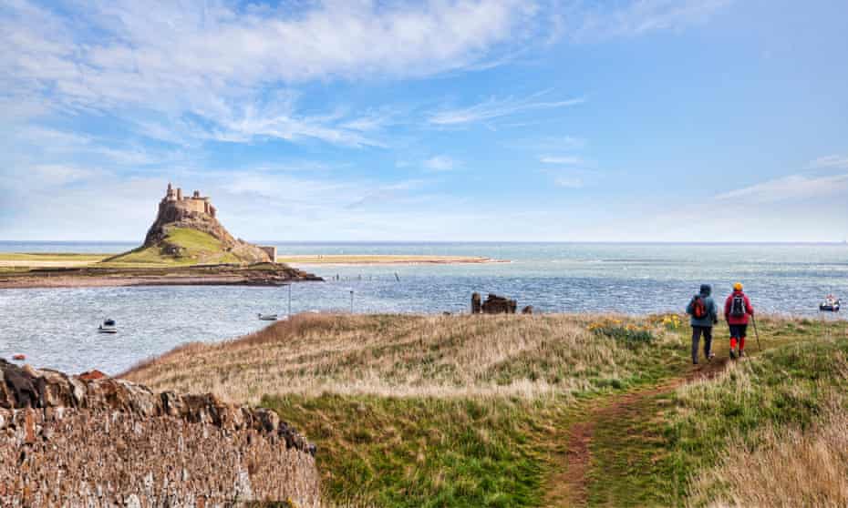
St Cuthbert’s Way is, according to Scottish outdoor writer Ronald Turnbull, seriously underrated: “It’s one of the best in the UK at this length and difficulty. Its gentle combination of moorland, woodland and riverside is just right, all below the 400m contour. A couple of ruined abbeys and a castle add to the mix, with a barefoot crossing of the tidal mudflats to Holy Island [Lindisfarne] the splendid bonus at the end.”
The trail runs from the Scottish Borders town of Melrose, where St Cuthbert entered monastic life in AD650, to Lindisfarne, his resting place. Along the way lie Eildon Hill and the River Tweed (both beloved of Sir Walter Scott), the town of Kirk Yetholm (endpoint of the Pennine Way, if you fancy peeling off), the wild Cheviots and St Cuthbert’s Cave, where, it’s said, the saint’s body was hidden in AD875 during Viking attacks.
Further information Visit stcuthbertsway.info. Research tide times at holyislandcrossingtimes.northumberland.gov.uk
before walking across to Lindisfarne
Tours Shepherd’s Walks Holidays offers guided trips from £965 and self-guided from £689pp
Battlefields and Borderlands Way, Leicestershire and Warwickshire
Start/Finish Witherley, Leicestershire
42 miles, 3-4 days
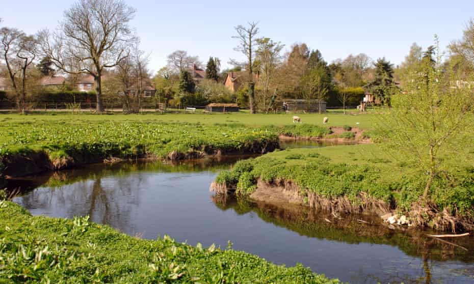
First port of call for any wannabe long-distance walker should be the Long Distance Walkers Association, which maintains a database of over 1,600 trails. Launched in 2020, the Battlefields and Borderlands Way is one of the newest additions to this treasure trove. It’s a circular route around the Leicestershire-Warwickshire border – once the frontier between Anglo-Saxon Mercia and the Viking Danelaw. Using footpaths and back roads, it visits some feisty areas, including the rediscovered location of Bosworth battlefield, the most likely spot of Boudicca’s final fight against the Romans, two English civil war sites and a cold war nuclear bunker.
“My favourite sections are the walks from Sutton Cheney to Stoke Golding,” says Eddie Smallwood, one of the route’s co-founders. “Not only is the walk through lovely countryside, it takes in several different eras and remarkable people and events.”
Further information The Battlefields & Borderlands Way is split into nine short sections; public transport is limited
Maps ldwa.org.uk
Guidebook Available from battlefieldsandbor.wixsite.com/home
Cumbria Way, Lake District
Start Ulverston
Finish Carlisle
70 miles, 5 days
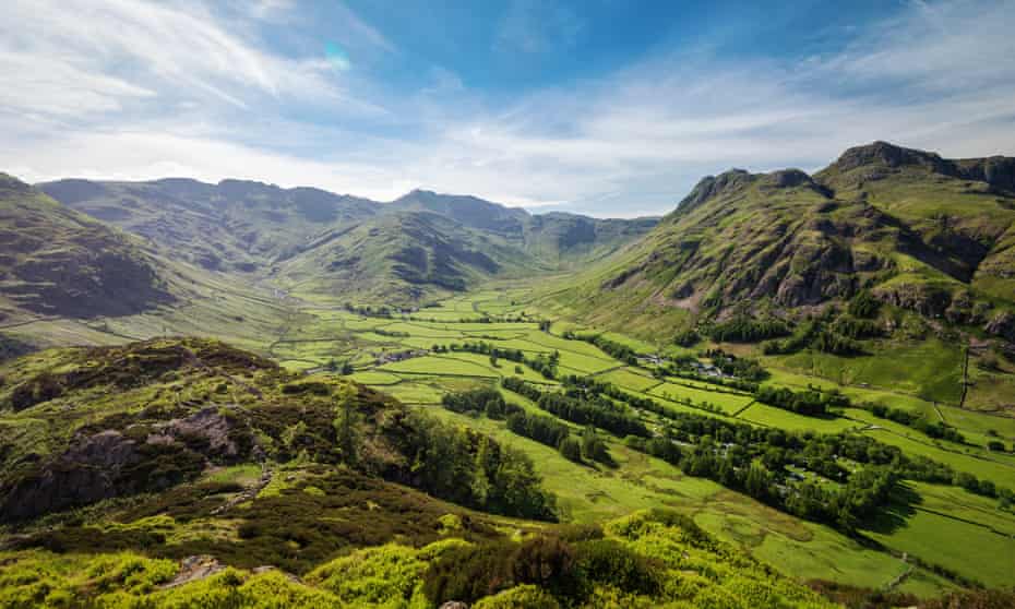
“The Cumbria Way should be a lot better known,” reckons Paddy Dillon, author of 90-plus dozens of walking guides. “It offers a relatively easy introduction to the Lake District, giving fine views of the fells without the effort of grappling with them.” Indeed, the Cumbria Way takes a lowish-level route across the national park, with only a few significant climbs, providing a gentler introduction for Lakes newbies.
From Ulverston the route winds alongside Coniston Water into Great Langdale, zigzags up a pass into Langstrath and Borrowdale, follows the wooded western shore of Derwentwater to Keswick, runs between Skiddaw and Blencathra to reach Caldbeck – either via Dash Falls or over High Pike (the route’s only Wainwright fell) – and traces the Caldew valley to Carlisle.
Those who have limited time are recommended to pick the central chunk, from Langdale to Caldbeck – classic Lakeland.
Further information Visit walklakes.co.uk to download notes and GPX files, and search for accommodation
Tours Macs Adventure’s seven-night Cumbria Way trip from £660pp
Cateran Trail, central Scotland
Start/Finish Blairgowrie, near Perth
64 miles, 5 days
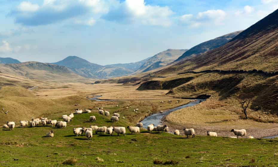
This history-infused loop through the Perthshire glens follows in the footsteps of the caterans, cattle rustlers who raided these valleys from the middle ages to the 17th century. The circular trail is split into five sections, each doable in a day, with a mix of low- and high-level walking.
Red deer, red squirrels, golden eagles, iron age settlements and ancient hut circles can be spotted. Those short on time should opt for the 20-mile mini-circuit from Kirkmichael: this follows the moorland trail and hill pass from Enochdhu to Spittal of Glenshee via the Upper Lunch Hut (where Queen Victoria rested in 1865); it returns to Kirkmichael via Glen Isla and the 18th-century Dalnaglar Castle.
Further information With no official start point, it can begin at Blairgowrie, 45 minutes by bus from Perth; other options are Kirkmichael, Spittal of Glenshee, Kirkton of Glenisla and Alyth
Maps/guides pkct.org/cateran-trail
Saint Patrick’s Way, Northern Ireland
Start Armagh
Finish Downpatrick
82 miles, 6-10 days
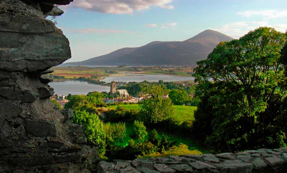
It was after walking Spain’s Camino de Santiago that Irishman Alan Graham decided Saint Patrick should be honoured with his own such pilgrimage trail – the obvious route being from Armagh, where the saint founded his first stone church in AD445, to his final resting place in Downpatrick. Luckily for walkers, some of Northern Ireland’s finest scenery lies in between, including the Newry Canal, Carlingford Lough, the Mourne Mountains and County Down coast.
Opened in 2015, the Way has its own Pilgrim Passport system: collect stamps at 10 points of interest en route to earn a completion certificate. The route is broken down into seven accessible stages; the final 10-mile section, along the coast where Patrick first brought his boat ashore, is rich in Christian heritage.
Further information walkni.com. Pilgrim Passports are available from local tourist information centres
Tours The Saint Patrick Centre in Downpatrick runs guided full- and half-day walks along the trail, and offers completion certificates
Glyndwr’s Way, Mid-Wales
Start Knighton
Finish Welshpool
135 miles, 9-10 days
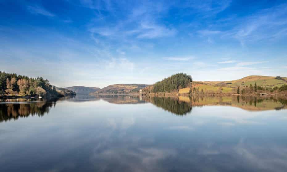
Though one of the UK’s 16 official National Trails, Glyndwr’s Way manages to fly beneath the radar – perhaps because, unlike the others, it follows no particular ridge or coast. Instead, it performs a sideways V, designed to link places with connections to Owain Glyndwr (the last Welsh Prince of Wales), and showcase the best of this quiet patch of Powys, taking in forests, views north to Snowdonia and the shores of Lake Vyrnwy. Even better, it has the quality waymarking of a National Trail but few other hikers.
Those with only a weekend free could try the 27-mile section between Llanidloes and Machynlleth (where Glyndwr set up his parliament in 1404); there’s public transport at both ends. Those with unlimited time could walk Glyndwr’s Way to Welshpool then follow Offa’s Dyke Path National Trail south back to Knighton, completing a 165-mile loop.
Further information nationaltrail.co.uk
Guidebook Cicerone publishes a Glyndwr’s Way guide
Tours Several walking companies offer self-guided holidays. Celtic Trails’ 10-night trip costs from £915pp
Dartmoor Way, south Devon

Start/Finish Ivybridge
108 miles, 10 days
Southern England’s wildest tract of land can be tricksy for walking – few waymarked trails dare streak across the high moor itself. So the Ramblers and the Dartmoor national park authority have developed the Dartmoor Way, a circumnavigation of the moor’s softer fringes, using footpaths, bridleways, byways and drovers’ roads.
The trail was meant to launch properly in 2020; this was postponed, but the route is ready to go. There are 10 stages, which start/finish in towns and villages. These include Ivybridge (which has a train station), Moretonhampstead (“gateway to the High Moor”), lively Chagford, Lydford (home to a gorge and castle) and the market town of Tavistock. An additional High Moor Link (23 miles) cuts across Dartmoor, from Tavistock to Buckfast, making it possible to break the Way into two shorter circuits.
Further information dartmoorway.co.uk. A Dartmoor Way cycle path also circles the park
Tours Encounter Walking Holidays offers various walks on the Dartmoor Way, with added tor-bagging detours, from £85pp a day
Wherryman’s Way, Norfolk
Start Norwich
Finish Great Yarmouth
37 miles, 2-3 days
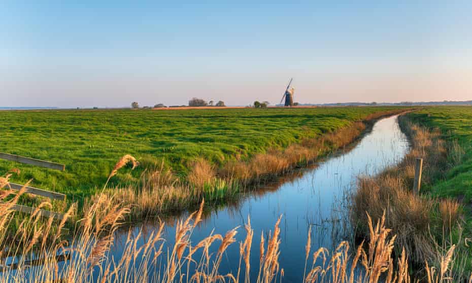
Just as classic gaff-rigged sailing wherries once tacked along the waterways of Norfolk, so too does this jinking trail, which follows the banks of the River Yare. Perfect for the hill-averse, this is an easy-to-follow walk through the Broads, Britain’s largest protected wetland – expect bird-flocked marshland, waving reedbeds, tiny villages and big skies.
There are numerous public transport links en route, not least the chain-pulled Reedham Ferry – the only crossing of the Yare between Norwich and Great Yarmouth – and Berney Arms, one of the country’s most remote and least-used railway stations. A good short option (5½ miles) is to take the train from Great Yarmouth to Berney Arms and walk back, via Berney Arms Windmill, RSPB Berney Marshes and the edge of Breydon Water.
Further information A map of the trail, and list of short walks, can be downloaded at norfolk.gov.uk
Guidebook A Wherryman’s Way guide by Joe Jackson was published independently in April
Landsker Borderlands Trail, south-west Wales
Start/Finish Canaston Bridge
60 miles, 4-6 days
Named after an old Norse word meaning “frontier”, the Landsker Line is a conceptual language border between the predominantly Welsh-speaking Carmarthenshire and English-speaking Pembrokeshire, dating back almost 1,000 years.
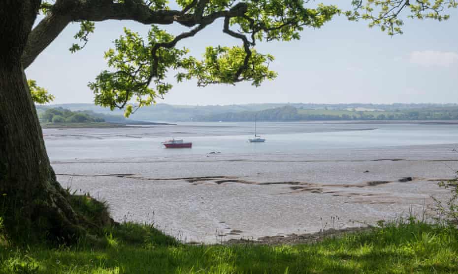
Another underused gem recommended by the LDWA, the Landsker Borderlands Trail flirts with the ancient boundary, leading hikers into south Wales’s undiscovered interior. That means days of rural walking via Daugleddau estuary, Carew Castle, the remains of Whitland Abbey, handsome churches (such as at Llampeter Velfrey), ruined Llawhaden Castle (a short detour), plenty of peaceful woodland and views of the Preseli Hills. Pubs and shops are scarce – part of the offbeat appeal – so come prepared.
Further information mudandroutes.com. Waymarking can be patchy – map-reading skills required. Canaston Bridge is accessible by bus, Whitland by train
Maps Ordnance Survey OL35, OL36, 177 and 185, shop.ordnancesurvey.co.uk
Tours Walk a Long Way provides luggage transfer services


